Day 9: One last stop
We awoke at 6:15 without an alarm, and showered in anticipation of a wonderful breakfast! Laura made some scrumptious banana muffins, and Charlie made a potato hash with fresh tomatoes. It was so good!
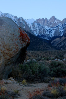
We loaded up the car one last time, and as we started off, I said, let's just use your phone for navigation since you already have our planned ride in your Google Maps. Had I used mine like we had for the entire rest of the trip, I would have realized I left it on the nightstand. Shoot! Laura is mailing it to me tomorrow. That's why I have no photos for today or yesterday. Anyway, the folks we talked to on the ride yesterday recommended a ride that would be somewhat on our way home from Charlie's at Alsea Falls, so we headed for it.
We arrived shortly before 11:00 (took us 2 3/4 hours) and got ready to ride. I studied the map at the reader board and worked out a ride, but just before we headed up, a local told us how to do it. We rode a paved road all the way to the top, and then rode down 100% singletrack! The first trail was Upper Whistlepunk. It was mostly flowy with lots of rises with big rocks. I kept freaking out about the rocks placed in the trail, but as I walked over four or five, I realized that they were 1) going to be there again and again and again on the trail, and 2) they weren't that bad to just ride over. I still had spaghetti legs, but I managed OK. The next trail was Lower Whistlepunk. I hit a rock wrong at the end of it and got bounced off the trail and fell into a tree. I bruised my knee, butt, and under my armpit somehow. But once I fall, that takes care of my nerves. After that, it was Highball Trail and great flow.
We got to going so fast and there were so many dips and jumps that I even let my front tire (only) catch some air. This is new to me, so I didn't want to get carried away (quite literally). And there was berm after berm on the corners that were so fun! We were both laughing as we enjoyed a roller-coaster section. Just as I was heading into a corner, I warned John, who was behind me, about getting up too much speed going into the corners. The next thing I knew, he was on the ground and rolling in pain. I think he end-oed over the handle bars. The visor of his helmet cut his ear pretty badly, and his helmet cut into his head. Since he landed face/head first, I did a concussion check; he seemed to be OK and wanted to ride, so down we went.
Honestly, this is the most fun trail I have ever ridden. If I were to ride it on a regular basis, I would probably lose my fear, ride too fast, completely catch air, and then slam into a tree. It's a good thing it's near Corvallis and not Duvall. Way too much fun!
We arrived home at 8:00 and I made some dinner out of trip leftovers, a salad from avocado, chickpeas, zucchini, cherry tomatoes, and crisped flour tortillas with some vegan cheese and a mayo-garlic-lime dressing. It was really good.
As for the other things we've learned that I alluded to for yesterday's post, here's what I would do differently. First, I would make sure to break up all long drives with a ride or run or ski. The second day we drove ten hours before skiing. Too long. The first day, we drove just six hours, biked, and then stayed there. We should have continued on. Second, I packed WAY too many clothes. This part is for my reference: I only need one bike short, one bike pant, one jacket, one long-sleeve, one running short, a couple running/biking shirts, four exercise bras, and then for street clothes, one pair of jeans, one or two T shirts, and one pair of shorts. As for food, don't pack bread. It molds even in the desert. Don't pack coffee. Do pack snacks and keep dinners light and fresh. Breakfast is best as a take-along on photo trips so you can eat it later on instead of 5:00 or 6:00 am.
Now it's time to plan the next trip. It's good to be home, but I can't wait to get out again.
Ellen
Once at Alsea Falls Recreation area (http://teamdirt.org/trail-guide/alsea-falls-rec-area/) we easily found the trailhead for the day's ride. Once biked up Ellen took a photograph of the map on the billboard. We have an app that tracks us but we don't have an app with the bike trails on it. They are out there but we haven't downloaded one yet. I wandered over to the billboard and struck up a one sided conversation with a woman. She was of no help and her facial expressions were of someone in social distress. Her riding partner was nice. One other rider came over and offered us insight about the trails.
We headed up a paved road and caught up with the negative lady and her delightful partner. We rode past them and soon after came to the proverbial fork in the road. We waited for the couple to see what they did. We followed them and then passed them again where a logger had his heavy equipment located in the middle of the logging road. The negative and her friend decided to walk their bikes cautiously around the equipment. Both engines were running. No operator was in view. He must have been over the hill hooking up his cables to logs. We walked our bikes between the two track holes which were chained together for stability. We made our way up the road to what we thought was the beginning of the Whistlepunk trail. We waited for the couple to catch up to us and they began their ride on the trail at that location.
 |
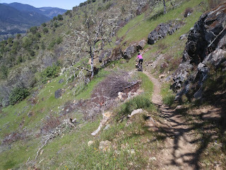
| Ellen has a snack in preparation for the downhill ride on singletrack. |
As we waited to give them space I lowered my saddle, checked the front shocks, and changed the gear setting from hill climbing to downhill. Ellen headed off first and immediately stopped to get around a drop off. Then her chain gave her problems, which she corrected. I gave her lots of space. I knew this was going to be somewhat beyond our skill and comfort level. We encountered numerous built-in rock mounds that created jumps. At first they intimidated us then we became comfortable with them. Ellen was moving downhill fast and with confidence. Whistlepunk was a well made trail and we found it challenging and a confidence builder.
We crossed a road and found the trail again. I thought the four mile grunt up the road was now worth it. We came to a intersection of roads and followed the signs to Highball trail and it was exactly as the guy at the billboard had explained: go down the logging road to the old picnic table on the left and find the trail. We kept going without resting and dropped immediately. This trail was different. It was groomed for intermediate riders. The dips and hills were spaced apart for jumping from one hill to the next, or riding sanely like we do up the hills and down into the dips and to the next set. Ellen yelled back to me that she was "catching air" on the hills. She was loving it. Then came numerous sections of sloped corners and combinations of hills and dips. Wow! What a great trail.
Ellen was ahead of me and I started into a banked curve and my front wheel went out from under me. I don't know what happened. Maybe it was my front brake or it could have been the dirt/clay that caused the bike to stop. I kept going head first into the red dirt. My helmet pushed hard on my right side of my head and I felt pain. My left wrist hit the dirt hard. I yelled out in pain. Ellen ran back and helped me gain my senses and get onto my feet. Shoot, my glasses had broken because the helmet crushed them against my skull. Blood appeared from my right ear apparently due to being cut by my glasses frame or the helmet visor. I checked myself and there were no broken bones. The wrist was merely sprained and bleeding. My neck was extremely rigid. It didn't want to move. My front brake lever was broken.
After Ellen checked my pupils I got back on the bike and tried to keep up with her as she sprinted downhill. I could see her head going up and down as she cruised through the hills and dips and around the corners. I couldn't catch up to her until she stopped at an intersection. Which way to go? This must be Springboard trail. I was ready to pull out the photo of the map on my phone when we heard riders coming down the trail. The two men screamed by us at an insane speed. We followed them to the parking lot. Wow. Now that was the best trail that I have ever biked. Someone knows how to make a biking trail. We will return.
I slowly changed back to cotton clothes and got into the driver's seat. My tight neck made it difficult to turn my head to use the side mirrors as I drove to Corvallis and I-5. Ellen took over at a gas station and drove the rest of the way home. Once in bed I slept with an ice pack under my head and a towel between my head and the pillow so I wouldn't bleed on the pillow. I had my best sleep for the entire vacation.
Nice to be home. Great vacation. Lovely scenery. Delicious food and drink. Incredible photo locations. Bad sky each morning and evening. Horrible traffic drivers on I-5 in California, Oregon, and Washington. I hate the weavers and especially the drivers that take up your safe space with the car in front of you. Ellen had done a wonderful job with the food, wine, driving, photography, riding the trails, me, and our accommodations. She is a great traveling partner.
John

Comments
Post a Comment